

Gas System Enhancement Plan
Massachusetts has one of the oldest natural gas systems in the country, with around 19% of the pipes under the ground considered ‘leakprone’ in 2022. Massachusetts created GSEP in 2014 as a way for its six investor-owned natural gas distribution companies to accelerate the replacement of this leaking infrastructure by 2039.
This work is costing rate payers around $0.5 billion a year, and according to an economic analysis the total cost of GSEP is expected to exceed $40 billion, making it one of the most expensive infrastructure projects ever undertaken in the state.
Given our state’s mandate to achieve net zero emissions by 2050, should we instead be investing this money into renewable, zero-emission energy systems?
About the map
Every November Massachusetts gas companies file rolling five year GSEP plans with the Department of Public Utilities (DPU). Since 2019, HEET has extracted and mapped the pipe replacement locations in these reports. The map visualizes for the first time the scale of these pipe replacement plans across the entire state, while providing a way for you to find planned gas pipe replacement projects in your area.
Note that the plans do not perfectly predict which streets the gas companies will be working on during those five years. This is because GSEP priorities and locations may be subject to change during the year due to various factors such as state and third-party construction work within a gas company’s service territory, permitting requirements and resource availability.
The map includes data parsed and geocoded from GSEP plans submitted to the DPU in 2023 (for 2024-2028).
About the plans
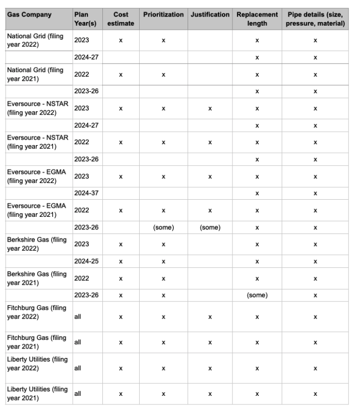
GSEP plans contain locations where pipes are planned to be replaced. The plans for the upcoming year have the most detail, including cost estimates, locations and prioritization. Less detail is given for the following years (2025 onwards). Information is not consistently structured or formatted consistently between utilities, or between years within utilities.

Using the Map
The map includes the following layers of information:
- 2024 planned locations and cost estimates for each utility, as filed with the DPU in 2023
- 2025-2028 planned locations for each utility as filed with the DPU in 2023
Controls
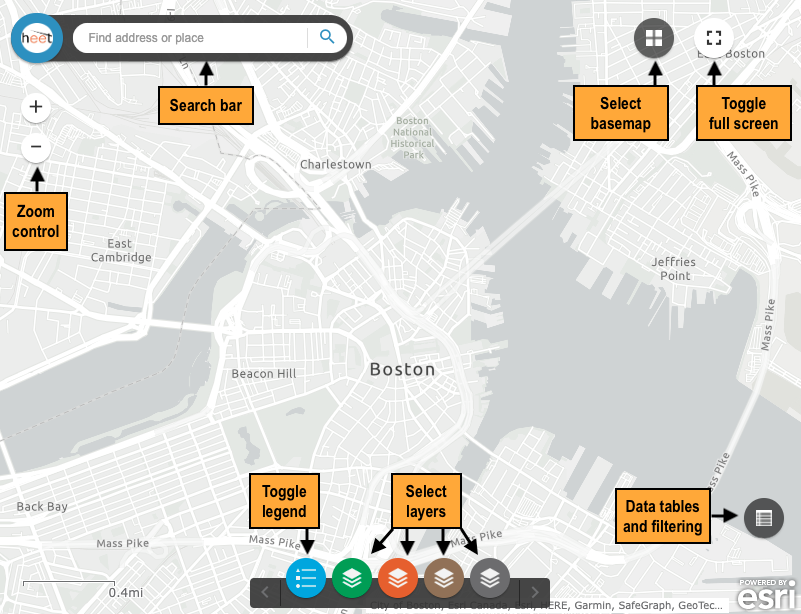
The map application provides controls for navigating and exploring.
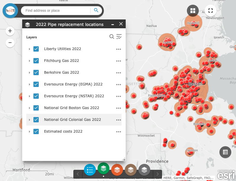
Layers
The map provides various layers of information which can be selected with the layer selection buttons. In the example below, all layers in the 2022 Pipe replacement locations group are turned on.
Interacting With the Map
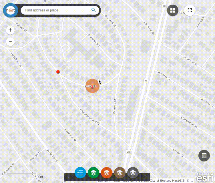
To see detailed information about a GSEP location, click on it. If multiple layers of information are available, use the Next feature and Previousfeature buttons to scroll them. In this example, we scroll between the details for a pipe replacement location planned for 2022, and the summary of the cost estimate for the projects’ locations. This particular project contained two pipe replacement locations – 4-140 Wellington Hill St, and 1-37 Duke St, Dorchester.

How the map was made
In 2019, HEET developed a new process for extracting and geocoding planned GSEP locations from the annual GSEP reports. This process continues to be advanced and improved. For example in 2022, an additional process step was added to maximize the accuracy of the extracted locations. The resulting data can be used in other analyses, research and mapping. In addition to being used to create this map, the data can be used in any mapping platforms that can consume geocoded data.
The process in overview is as follows:
- Annually reported GSEP data is obtained from MA DPU
- The data is reviewed, selected and then extracted from the reports with HEET proprietary data parsers
- The GSEP locations are geocoded using HEET proprietary software
- All geocoded locations are reviewed for errors in the original utility GSEP location addresses, as well as any issues with the geocoding addresses that occasionally occur
- Corrected addresses are geocoded again, and any unresolved issues are manually dealt with to identify the best matching location and GPS coordinates
- Due to the inconsistent formats and structures of the reported data, automation only goes so far, so a second extensive manual process added in 2022 is now performed to maximize the accuracy of the final locations
- The final results are merged back into the original reported plans
- After final testing, the data is baked and ready for sharing or mapping.